Earth Representing Methods
Basic ways are Shepre, Ellipsoid/Spereroid , Geoid ,
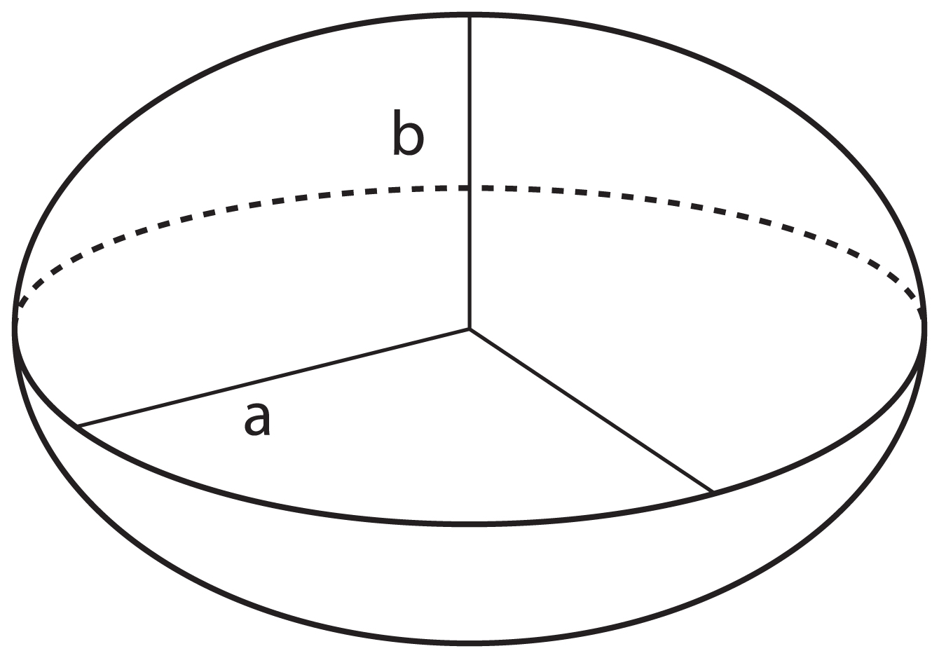
Representing Earth as a Sphere
Earth is considered as a Sphere and it divided in to imaginary lines called parallels and meridians, and these imaginary lines are used to form Geographical coordinates Latitudes and longitudes,
.jpg)

Latitudes
(shown as a horizontal line) is the angular distance, in degrees, minutes, and seconds of a point north or south of the Equator. Lines of latitude are often referred to as parallels. Latitudes angles are measured in
north-south direction and it ranges between 0-90 , latitude lines separated the earth in to Northern ans southern hemispheres and by definition northern measurements considered to be positive and Southern measures are negative but this is not a standard.
Longitudes
(shown as a vertical line) is the angular distance, in degrees, minutes, and seconds, of a point east or west of the Prime (Greenwich) Meridian. Lines of longitude are often referred to as meridians.
Longitudes are measured i East-West direction and the angle is ranges between 0-180 degrees,
Longitudes separate the earth in to Eastern and Western hemispheres and same as the previous hemisphere western measurements are positive and eastern measurements are negative ,
Representing as an Ellipsoid / Spheroid
When technically looking at the shape of the earth , it's not a sound sphere , but it's more like a ellipse
when by considering the earth as a ellipse flattering value is important factor and flattering is gain by


( semi Major axis - semi minor axis ) / semi minor axis
* semi Major axis is the longest diameter and semi-minor axis is the short diameter
Representing Earth as a Geoid
When considering the earth as an ellipse , actually the real shape is still slightly different than an ellipse , because there are seas and mountains and so many geo objects that changes the shape of the earths surface so to get these kind of a actual shaped earth we need to use a Geoid.

and when using ellipsoids and Geoids it's hard to use the same ellipsoid for all the locations of the earth , and as a solution for this introduced different ellipsoids for different locations
Datum
A datum is a mathematical model of the earth surface which helps to get the measurements and the coordinates of the earth.and in different parts of the earth and for various reasons there are so many datum which are most matching for the location and the purpose.
some datum examples are : North American Datum,Origin datum, ...etc
No comments:
Post a Comment